

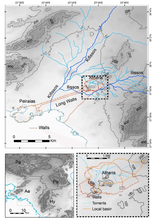
The study focuses on the urban wastewater and stormwater techniques at ancient Athens and relies extensively on archaeological evidence spanning from the Classical to the Late Roman period. Torrential rainfalls represent a significant fraction of the average annual precipitation of 400 mm in Athens and this necessitates an effective drainage system.
Furthermore, local geology favours surface run-off of rainwater since the broader area is covered by schists and only about 5% of the precipitation penetrates the ground. A well-organized infrastructure for water supply, rain water drainage and sewers, as well as a municipal service for the collection and disposal of lavatory waste existed in Athens since the 5th century BC.
 Loading…
Drainage and sewerage works were adapted to the topography, the natural network of streams and rivers, the streets and the moat trench of the fortification. The social structure which supported the regular operation is of special interest.